Saturday, August 27, 2016

Gunung Angsi, Negeri Sembilan via Ulu Bendul

gunung angsi
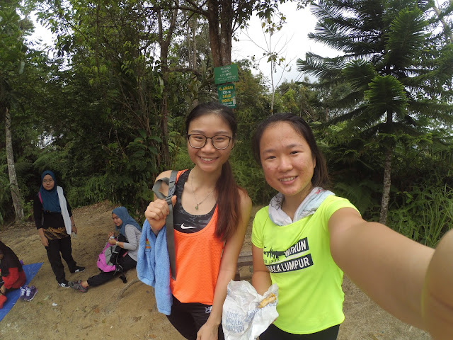
Both of us got stung by Bee at the begining of our hikes and from stranger we become friends :)


Gunung Angsi is located in Ulu Bendul Recretional Park, about 20km from Seremban, the capital of Negeri Sembilan. It is one of the minor mountain in Malaysia which has a height of 2702ft or 824m. Gunung Angsi is 3rd highest peak in Negeri Sembilan state after Gunung Datuk and Gunung Bintongan but 241st highest in Malaysia. Malaysia. It takes approximately 1.5 hour driving from Klang but only an hour from KL Town. The hiking distance via Ulu Bendul will take 8km for one-way but Bukit Putus routes only take half of it which is 4km for one way. Therefore, many said that via Ulu Bendul is a much challenging route.

This is my first time went hiking at Gunung Angsi, I decide to join a new friend - James who I met at Gunung Datuk in previous week together with his Muar Hiking Gang who he met during his previous hiking at Apek Hill. (what a small world?)


Since we have to gather with #muarhiking group who came all the way from Johor and some from Melaka at 7.00 am at the entrance of Gunung Angsi Starting point. I depart from my house at 5.00 am and reach James' house at 5.30 am. We decide carpool with James' car together with his another friend-Jessie. So, Jessy and Jessie go hiking with James and his gang. 


Getting There (60 minutes from KL Town)


To enter Gunung Angsi, you have to pay a permit at RM5, as well we fill up our name, contact number, home address to prevent missing during our hike. Me, James and Jessie as well pay another RM11 for transportation via Bukit Putus route coming back to entrance when descending and also for the fee of two jungle guide who lead us via Ulu Bendul.


gunung-angsi-permit.jpg
Permit

While waiting the rangers to lead us, we start our warm up session with Jason and introduce ourself to each other. Honestly, I am not able to remember all of them but I believe most of them must had remember me so well as result of bee incident.

Carpark via route Ulu Bendul

Hiking Up

As the clock strikes to 8.30 am, one of the rangers arrive and we decided not to wait for another  and start of jungle trekking for the first hour. 

gunung-angsi.jpg
starting point via Ulu Bendul


For the first 2km, we walk through the trail beside a river and met a group of giant millipedes family. Although all of them looks about 20cm long and 3cm thick, in fact they are still baby because from the light color of their body. 


millipedes
Giant Millipedes Baby

After 5 minutes walk from baby millipede, we met this adult millipede and I called it "papa" (father) of those millipedes just now. 


millipedes
Giant Millipedes Daddy

We stopped at this pondok to gather with others team members also do our headcount before proceed together, and this is where my nightmare begins. After getting 5 minutes from this point, I passed by an area with flowers and bees which I do not take cautions about it. Without warning, I feel pains coming from near to my waist and another pain from my leg. When I realize it was already too late as the bee had attach on my leg and I have to hit it away and run in front to sit on a boulder.

There is another girl who also sitting in front having bee stung on her thigh and me is calf also my waist. It is so pain and my tears run a bit from my eyes but after apply balm I keep moving and cross over two stream hoping that I can forget the pain HAHA.

Until some points, James asked me whether I am OK which I still holding the pain and tears. Then one of the member ask me stop to check for my wound and also bring me the Panadol (pain and fever killer). Out of sudden, she press my wound at my back again both my eyes filled up with tears and this time it flows like a waterfall :( It is so shameful until today.
gunung-angsi.jpg
checkpoint via Ulu Bendul - Pondok


About 1.5 hours from the pondok, you will see this "Lazy Log 2" sign and a signboard saying "7 MINS TO SUMMIT". Literally, we got fool by the 7 mins or maybe it should be 57 mins or 47 mins instead of just 7. 

gunung-angsi-via-ulu-bendul.jpg
checkpoint via Ulu Bendul - Lazy Log 2

gunung-angsi-via-ulu-bendul.jpg
7 MINS TO SUMMIT

After 7 mins, we reach this point which require climbing skill using rope and where we start our real steep journey of 2km to reach the peak. The total ascending of this 2km reach almost 450m in total which Gunung Angsi only stand a height of 824m. 

gunung-angsi-via-ulu-bendul.jpg
Result of 7 min to summit ** erhemm!!**

gunung-angsi-via-ulu-bendul.jpg
Steeply uphill for 1 hour

By moving slowly with minimum stop, we took about 1 hour from the "Lazy Log2" to reach the summit of Gunung Angsi. Photo session and lunch for celebration while waiting for another 2 team members.

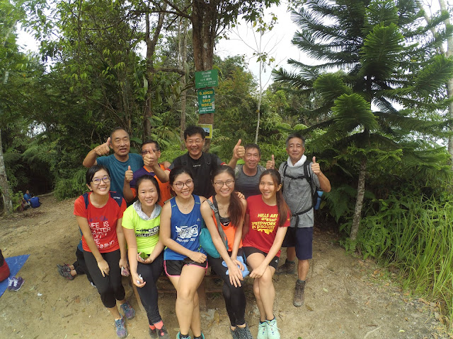
Jessy - James - Jessie

gunung angsi
Pretty ladies and macho uncle

gunung angsi
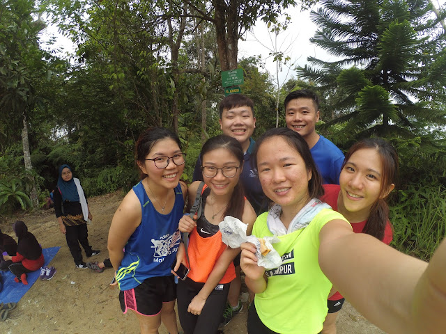
Newly met people at the summit

I met my "bee stung" buddy with her gang at the peak. After having group photo and rest for 1 hour, we take Bukit Putus route for descending.

About 20 minutes from peak, we reach a viewspot called "waterfall view" that couldn't found any waterfall view. However, it is still a good spot which worth to pause a break for photography.

gunung angsi via bukit putus
Checkpoint 2 via Bukit Putus - "Waterfall view"

We move on in 40 minutes later and pass by a small hut equipped with some cooking utensil. There is a few hikers were gathering around, we greet each other and continue to finish until the end.


gunung angsi via bukit putus
Checkpoint 1 via Bukit Putus

gunung angsi via bukit putus
Does it looks like Nami Island from Korea?

Finished our hike, we took the van with Muar Hiking Group back to our starting point to use the washroom clean up ourselves, they do collect a small fee of 20 sen/person for each entry.

Things to Prepare:
Water 1.5L (minimum)
Isotonic Drinks
Chocolate and energy bar
Salt/ Salt Mist (got leeches)
First Aids Kits/ Balm
Proper hiking shoes
Hiking stick (recommended but optional)
Raincoat (optional)
Extra pair of shirts and pants for changing after hike

Starting Coordinates2.727418N ,102.0758E (Ulu Bendul)
Difficulty: Moderate to Hard
Average Completion Time: 5 hours (3.5 hours uphill via Ulu Bendul and 1.5 hours downhill via Bukit Putus route)


gunung angsi via ulu bendul
All Ladies :)
gunung angsi
The End with Muar Hiking


Sunday, August 21, 2016

Bukit Kutu, Kuala Kubu Bharu, Selangor


bukit kutu hilltop
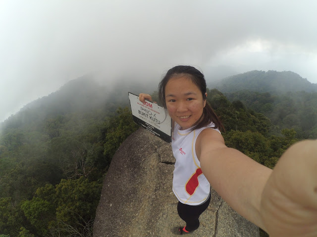
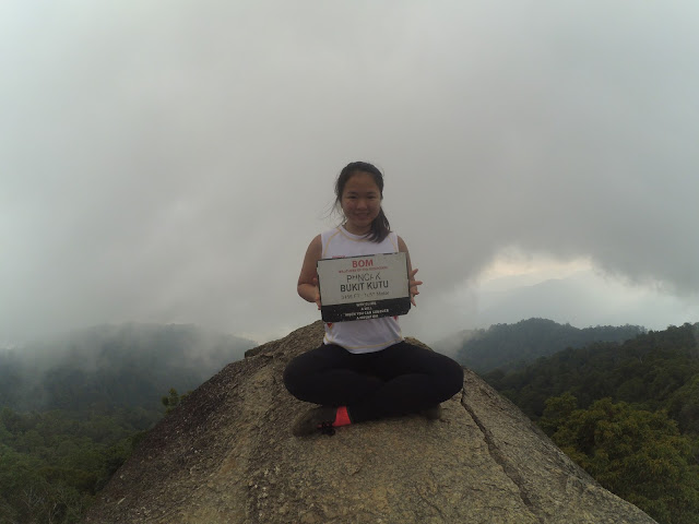
BOM! I made it to the peak of Bukit Kutu! **my leg is so shakkyyyy**


So finally! I complete Bukit Kutu, a hill which I had talking so long!


bukit kutu
1053M Bukit Kutu, take it slow, to reach the peak
Bukit Kutu a.k.a Treacher's Hill is located at Kuala Kubu Bhara, Selangor, Malaysia. Driving to Bukit Kutu takes approximately 1.5 hour from Klang as well as KL Town. Although Bukit Kutu is categories as hill, but it have a height of 3456ft which equal to 1053m above sea level. It took us 3 hours from entrance to reach the peak and 2 hours from peak to parking entrance with a total of 12.53km distance. For a more relax hike it might take 4 hours to uphill and 2.5 hours going down.


Getting There (90 minutes from KL Town)

If you are coming via the highway, exit via Bukit Beruntung and head towards Kuala Kubu Baru. Cross ahead of Kuala Kubu Baru and head directly towards Kampung Pertak. After the second bridge, from Kuala Kubu Baru, you will see a sign which points towards Kampung Pertak, where you will take a right turn into Kampung Pertak. From there, go straight until you reach the gravel (small stone and sand) road. The entrance bridge will be up ahead will be the entrance to Bukit Kutu.


maps of bukit kutu
Location of Bukit Kutu


Hiking Up
The important thing to remember about the route in Bukit Kutu is, do not take any left turn during the first hour of the hike. You will cross two small rivers as well during the first part of the Bukit Kutu hike and a broken bridge as well. Don’t bother trying to not get your shoes wet. It will eventually get wet further in the path.

There will be a few checkpoints along the way but if you keep towards the right path during the first hour, you will be on the correct route. There are markers along the Bukit Kutu trail as well in the form of red caution tape tied to trees, so feel free to follow that as well.

There will be a lot of bamboo trees along your path. If you notice unbelievably tall bamboo trees and fallen ones blocking your path, you are on the right track. Just crawl under them.

bukit kutu bamboo forest
Trees

Along you way, you will come across steep root climbs like the one that you see below. Please watch your step at this point. It is very easy to tumble and injure your legs here.

bukit kutu roots trail
Be Caution for here, you might strain your feet

Besides, you might see these dogs from entrance or follow you all the way to the peak, or resting some where like a boss. Is about total of 4-5 dogs we had seen and this is 2 of them.

rangers in bukit kutu
Our Jungle Guide, they are friendly, so don't worry :)

Two hours into the hike, you will reach one of the common checkpoint, the tall stone wall. It’s an amazing spot to take a break and take some really amazing shots. Please refrain from damaging the stone wall and feel free to absorb in the air of magnificence around the area. You are one hour away from the peak at this point.

bukit kutu checkpoint
checkpoint of bukit kutu, from here to the peak take another 1 hour journey

Once you reach the chimney, you are almost at the summit. The right path of the chimney leads to the summit boulder and the path behind the chimney leads towards the old ruins. The chimney is said to be a leftover from one of the buildings back in the times. 

peak of bukit kutu

Be very careful when you are moving around the last boulder. There will be no ropes or anything to support you on your side. Falling from the last boulder will cause unimaginable injury.

bukit kutu
Baby Ong Again! One more last step to the highest top of peak

bukit kutu
This Stone is only reserve for one person to maximum 2 per times, I am too scared at first

Hiking down the track will take you another 2 hours but please take it slow and refrain yourself from jumping down the ledges. The pressure on your knee from landing will be very damaging in the long run. Once you reach the river at the bottom, it’s time to enjoy yourself with some swimming in the cool freshwater river.

Things to Prepare:
Water 1.5L (minimum)
Isotonic Drinks
Chocolate and energy bar
Proper hiking shoes
Hiking stick (recommended but optional)
Raincoat (optional)
Extra change of socks
Extra pair of shirts and pants for changing after hike

Starting Coordinates: 3.572510N, 101.738128E
Difficulty: Moderate but some area is very steep
Average Completion Time: 6 hours (4 hours uphill and 2 hours downhill)


bukit kutu
The END - the only group photo we had

Sunday, August 14, 2016

Mossy Forest, Cameron Highland


Jessy in the Wonderland


Ahha! Mossy Forest!

Mossy Forest is a small hiking place which located in Tanah Rata Cameron Highland of Malaysia. It takes approximately 4 hours driving from Kuala Lumpur. Driving up to Cameron is not an issue but to reach the entrance for Mossy Forest, you have a go thru by a super narrow road for 6 km, just be prepare to hurt your lovely car a little bit.


Entrance

We depart from Klang, Selangor in the morning 5am and drive all the way up to the entrance of  Mossy Forest at 9am. The parking area is full of car so make sure to car pool as much as you can if really plan to go.

At the entrance of Mossy Forest you will find a map as below.

Map

The starting point is pretty easy because it is well maintained with staircase, go straight until the end and turn left you will find the real starting point.

Mossy

One of my Favourite

It required both your hands and legs to work together and be prepare to get yourselves into the muddy road. The whole journey from Entrance to Mini Irau take us about 2.5 hours for 3 km and 1.5hours from Mini Irau back to entrance. Total of 4.5 hours to complete a total distance of 6km. If you are fit enough, you can proceed to Gunung Irau which is just 45 minutes from Mini Irau. However, there is no experience guide to lead us on the day and there few of people from our group had exhausted, we decide to stop at Mini Irau until the next return.

My colleagues from China and Taiwan and also my friends
Kennee and me

The sea level at Mini Irau is 6666ft which equal to 2031m, don't get shock by this number as the entrance of Mossy Forest is already located at 6561 ft (2000m). Therefore, we started our journey downhill then only uphill.

Please take note that the forest temperature during day time 1000-1700 is between 21-24 Celsius, for other time 1700-1000 will be 6-14 celcius. April, May, Ogos, September, October and November will be rainy season. So bring whatever that require to be prepare before you regret.

Muddy Route
with many roots
Baby Ong - this is what she suggest everyone to call her 


Things to Prepare:
Water 1L (minimum)
Chocolate and energy bar
Proper hiking shoes (Kampung Adidas is more preferable, easy to wash)
Hiking stick (recommended but optional)
Pair of gloves (optional)
Windbreaker/Jacket (optional)
Raincoat (optional)
Extra change of socks
Extra pair of shirts and pants for changing after hike

Starting Coordinates: 4.524216N, 101.381937E 
Difficulty: Easy but mindful for the muds and roots
Average Completion Time: 4 hours ( 2.5 hours uphill and 1.5 hours downhill)

Muddy Hands

The End
If you have any questions, please feel free to drop them at the comment section below. Thank you! 
:)


Sunday, August 7, 2016

Gunung Datuk, Rembau, Negeri Sembilan

Gunung Datuk 2500ft above sea level

Gunung Datuk is located at Rembau, Negeri Sembilan, Malaysia. It takes approximately 2 hours driving from Klang but only 1.5 hour KL Town. The highest point of this mountain is around 2900 ft (885m). It took us 2 hours to reach the summit and it took me another 2 hours to back to entrance due to I am not good in condition that day, maybe I got too hungry? Bringing food like biscuit/ bread/ even nasi lemak will be a must for my visit.

History

A long time ago, before Tanah Melayu became Malaysia, Negeri Sembilan was ruled by the Minangkabau, a people originally from West Sumatra (Indonesia). There's a systen called Adat Perpatih that was introduced by a leader named Datuk Perpatih Nan Sebatang. Local people believe that long ago, this mountain used to be a place where people gathered and select their leader.

There are also a footprints at the summit which represent the legendary warrior called Hang Tuah. Myths say that he used to move from one place to another by jumping mountain to mountain.

Getting There (90 minutes from KL Town)

From highway, exit the North-South Expressway at E223. At the T-junction after the toll, turn left. You will reach a round about where you should turn right (3rd exit) towards Rembau. From Rembau town, you will see signposts directing you to Hutan Lipur Gunung Datuk which will take you along route N111. After 15km, turn left into Gunung Datuk and you will arrive at the base camp after a short drive through rubber state.

2.534911N, 102.163506E


Hiking Up

To climb this moutain, you need to pay the permit for RM5.00/person, it will located at the entrance when you see the sign of Puncak 2010M.


This is not the height, is the total distance to the peak


At the beginning of trail, keep to the right when you reach a T-junction. The trails starts to climb immediately for the first hour, you will required to cross over all the twisted tree roots and rocks.


Along the way, you can find the arrow pointing the distance remaining to reach the peak, and this is 50M to arrive.
the last 50m to reach the peak
After a while, the path become slightly less steep and more easy to walk. When you reach a big stone wall as below, it will took another 15 minutes to reach an open area below the summit which normally us as a campsite.


Giant Rock

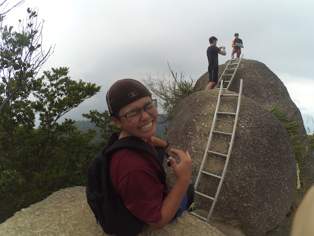
From here, you will need to use the steel ladder to climb up the massive boulders which so called as the peak of the mountain. The ladder is a bit loose, just continue climbing up then you can enjoy the magnificent views from top. You can feel the strong wind when climbing up from the steel ladder which make me feel very unsafe.


The steel ladder


While waiting the queue for steel ladder

Coming down will be the same route but it is a hard mission for the leg muscles and knees. I recommend to use a hiking stick and wear the knee protector which I believe it can prevent the knee pain for getting down.

I got no idea, but it is extremely hot to open the eyes and face camera

Things to Prepare:
Water 1.5L (minimum)
Isotonic Drinks
Chocolate and energy bar
Proper hiking shoes
Hiking stick (recommended but optional)
Extra pair of shirts and pants for changing after hike

Starting Coordinates: 2.534911N, 102.163506E
Difficulty: Moderate (first hour will be very steep)
Average Completion Time: 4 hours (2 hours uphill and 1.5 hours downhill)


The End